


Voting Districts not defined, Sanilac County, Michigan
About
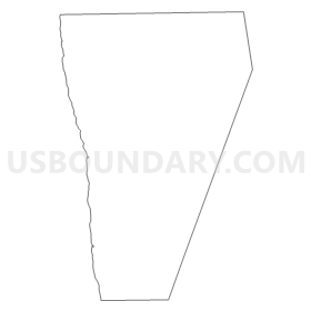
Outline
Summary
| Unique Area Identifier | 599525 |
| Name | Voting Districts not defined |
| County | Sanilac County |
| State | Michigan |
| Area (square miles) | 625.85 |
| Land Area (square miles) | 0.00 |
| Water Area (square miles) | 625.85 |
| % of Land Area | 0.00 |
| % of Water Area | 100.00 |
| Latitude of the Internal Point | 43.47343010 |
| Longtitude of the Internal Point | -82.37742600 |
Maps

Graphs
Select a template below for downloading or customizing gragh for Voting Districts not defined, Sanilac County, Michigan


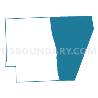
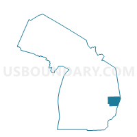
Neighbors
Neighoring Voting District (by Name) Neighboring Voting District on the Map
- Voting District 1471202000002, St. Clair County, MI
- Voting District 1512138000001, Sanilac County, MI
- Voting District 1512950000001, Sanilac County, MI
- Voting District 1514730000001, Sanilac County, MI
- Voting District 1517158000001, Sanilac County, MI
- Voting District 1518876000001, Sanilac County, MI
- Voting District 1518876000002, Sanilac County, MI
- Voting Districts not defined, Huron County, MI
- Voting Districts not defined, St. Clair County, MI
Top 10 Neighboring County Subdivision (by Population) Neighboring County Subdivision on the Map
- Burtchville township, St. Clair County, MI (4,008)
- Worth township, Sanilac County, MI (3,894)
- Lexington township, Sanilac County, MI (3,658)
- Sanilac township, Sanilac County, MI (2,431)
- Sherman township, Huron County, MI (1,083)
- Forester township, Sanilac County, MI (1,011)
- Delaware township, Sanilac County, MI (856)
- County subdivisions not defined, Sanilac County, MI (0)
- County subdivisions not defined, St. Clair County, MI (0)
- County subdivisions not defined, Huron County, MI (0)
Top 10 Neighboring Place (by Population) Neighboring Place on the Map
Top 10 Neighboring Unified School District (by Population) Neighboring Unified School District on the Map
- Croswell-Lexington Community School District, MI (14,438)
- Harbor Beach Community Schools, MI (4,585)
- Deckerville Community School District, MI (4,436)
- Carsonville-Port Sanilac School District, MI (3,720)
- School District Not Defined (Water), MI (243)
Top 10 Neighboring State Legislative District Lower Chamber (by Population) Neighboring State Legislative District Lower Chamber on the Map
- State House District 81, MI (95,883)
- State House District 84, MI (88,847)
- State House District 83, MI (88,414)
Top 10 Neighboring State Legislative District Upper Chamber (by Population) Neighboring State Legislative District Upper Chamber on the Map
Top 10 Neighboring 111th Congressional District (by Population) Neighboring 111th Congressional District on the Map
Top 10 Neighboring Census Tract (by Population) Neighboring Census Tract on the Map
- Census Tract 6320, St. Clair County, MI (4,008)
- Census Tract 9512, Huron County, MI (4,007)
- Census Tract 9705, Sanilac County, MI (2,430)
- Census Tract 9706, Sanilac County, MI (2,291)
- Census Tract 9701, Sanilac County, MI (1,866)
- Census Tract 9707, Sanilac County, MI (1,535)
- Census Tract 9900, St. Clair County, MI (0)
- Census Tract 9900, Sanilac County, MI (0)
- Census Tract 9900, Huron County, MI (0)
Top 10 Neighboring 5-Digit ZIP Code Tabulation Area (by Population) Neighboring 5-Digit ZIP Code Tabulation Area on the Map
- 48059, MI (15,123)
- 48450, MI (4,780)
- 48441, MI (4,085)
- 48427, MI (2,879)
- 48419, MI (2,740)
- 48401, MI (1,439)
- 48469, MI (1,245)
- 48465, MI (629)
- 48434, MI (104)